for Sustainable Communities
Neighbourhood
Patterns Compared
This chapter presents important background information that helps explain the impact of design standards to the configuration of our streets and consequently of our communities, and ultimately to the stability of our region. In this chapter we examine three distinctly different ways of building neighbourhoods.
The first two communities discussed are real neighbourhoods located within the greater Vancouver region. The third is a hypothetical neighbourhood proposed by one of the four design teams during the first Design Charrette for Sustainable Urban Landscapes. We compare and contrast these three neighbourhood patterns in order to answer certain recurring questions about the relative merits of each pattern.
We refer to the first of the three neighbourhoods as the "Status Quo" pattern because it is typical of most new neighbourhood development in our region. We call the second one "Traditional" because this pattern was ubiquitous in most North American cities prior to the end of the Second World War. The third community pattern is named the "Traditional Pattern with an Ecological Underlay" because it takes on the basic arrangement of the Traditional Pattern while still preserving and enhancing the natural systems of the site. It is this third pattern that was proposed by the participants in the Surrey design charrette as a practical way to make our communities more socially and ecologically sustainable. In this project we have taken their ideas a few steps forward so that they can be productively compared with the other two real sites.In the comparison matrix we identify the following aspects of each of these three sites: building use, housing density, surface permeability, road right of way geometry and construction, utility line locations, property line locations, and building setbacks.
In the last section we model the development of a 46 square kilometre (11,500 acre) tract of sparsely developed land in Langley Township, BC two different ways. First we examine the ecological and urban design consequences for this land if it were developed in conformance with existing planning, engineering and subdivision regulations. We then take the same land and examine the ecological and urban design consequences for this landscape if it were developed in conformance with an alternative set of regulations, regulations specifically designed to encourage more sustainable communities.
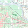
Status Quo Pattern
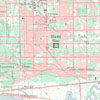
Traditional Pattern
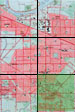
Traditional Pattern
with Ecological Underlay
Status Quo and Traditional Pattern
Comparison Matrix
Langley Township
Case Study Comparison