Illustrative Site Plan
|
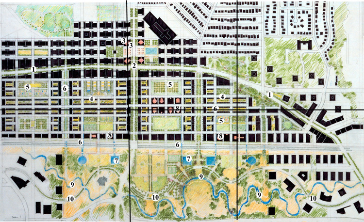
Concentrated commercial and residential uses accompany at-grade light rail along the Lougheed corridor (1). The primary transit stop (2) straddles the intersection of Lougheed Highway and Willingdon Avenue and is tightly integrated with car, bus, and pedestrian traffic. Together with the placement of civic buildings (3) and open space, this area becomes a lively and distinct community hub. To the south of Lougheed Highway, medium-density ground-oriented housing (4) forms around central working greens. Allotment gardens, orchards (5), laneway swales and surface channels (6), as well as rooftop cisterns, assist in the management of surface water. Surface water is channeled to retention ponds (7) which form an ecological and social function at the edge of Still Creek. Neighbourhood schools (8) are proposed to the south of the site. The restored Still Creek basin (9) serves as the ecological backbone of the site. To the north of Still Creek, retention ponds and wetlands filter runoff before it reaches the stream course, while also providing valuable habitat for wildlife. An urban trail system supports recreational opportunities for the community (10). |
||||
 click
quadrant to see detail click
quadrant to see detail |