SUSTAINABLE URBAN LANDSCAPES
Alternative
Development Standards
for Sustainable Communities
for Sustainable Communities
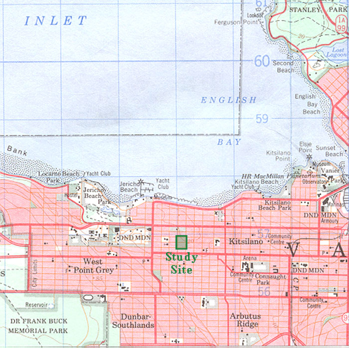
Community Context
| A topographic survey map showing the Traditional Pattern study site within its community context. On this map urbanized areas are shown in pink, forests in green, and agriculture and open space areas in white. The deepwater Burrard Inlet bounds Vancouver to the north and is bordered by a steep ridge and plateau which forms the Kitsilano community. The study site is located on nearly flat land between the east-west running 4th and Broadway corridors. These avenues provide for most of the commercial needs of area residents and act as public transit corridors to connect residents to jobs, recreation, and other commercial centres. The 0.03 square kilometre (7.4 acre) study site is demarcated by the green rectangle. |
 |