The
following four conceptual plans show how a reconfiguration
of the sites existing road and subdivision pattern influenced
Team Threes concepts of water management, urban design, and
land use:
Road Hierarchy
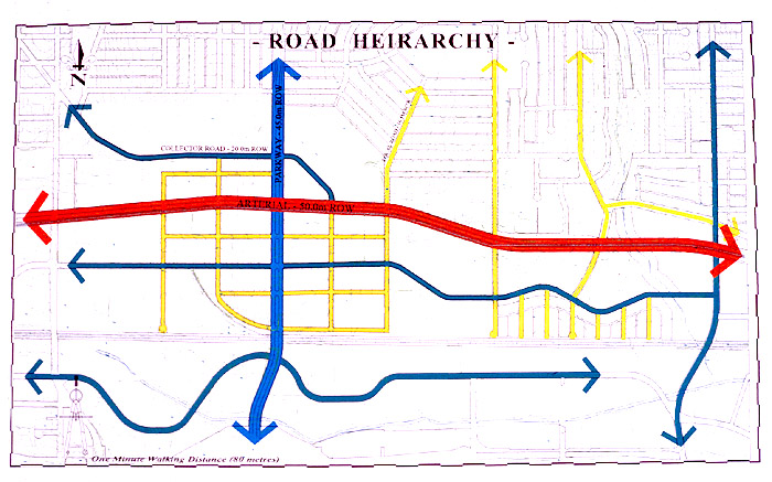
In
this road hierarchy plan, the 300-by-600 foot grid provides
a finer grain than does the sites existing road structure.
Unlike the typical suburban-type street pattern, an interconnected
road pattern structured around such a grid allows better,
more walkable connections between local destinations.
Land
Use
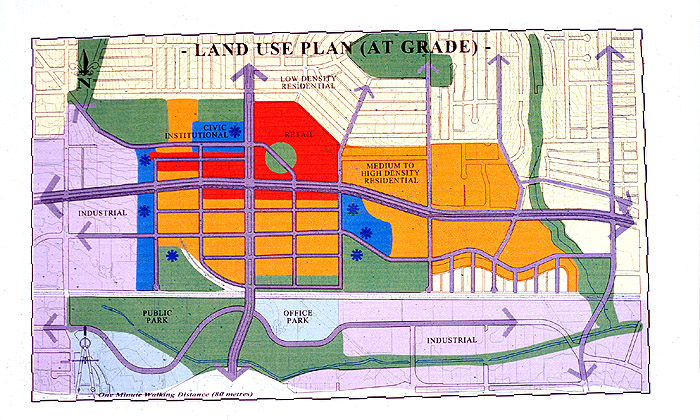
The
majority of medium- to high-density housing occurs at the
centre of the site. High-density residential towers are integrated,
as an upper-storey component, with commercial and retail uses
along the primary arterials. Industrial areas are proposed
at the southeast edge. Public buildings are framed by the
grid and are grouped with recreation and open spaces. Parks
and civic spaces facilitate the transition from current to
future uses, which could include moving from industrial to
residential use.
back
Surface
Water Management
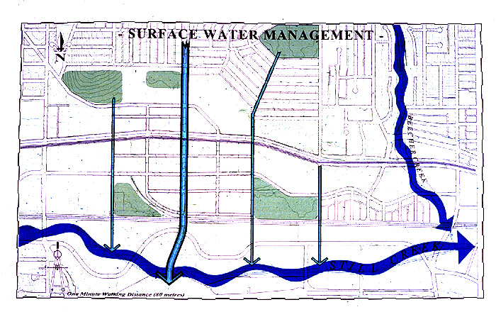
A
system of bio-swales, that will drain into the Still Creek
aquatic system, is proposed along each of the prominent north-south
axes. The Willingdon Avenue Parkway is the most prominent
of these, where a concave landscaped boulevard becomes a biofilter
and surface drainage channel for rainwater runoff. Subsidiary
north-south routes are aligned with local streets and become
irrigation and drainage channels for local neighbourhood use
before making their way to Still Creek.
back
Urban
Design Framework
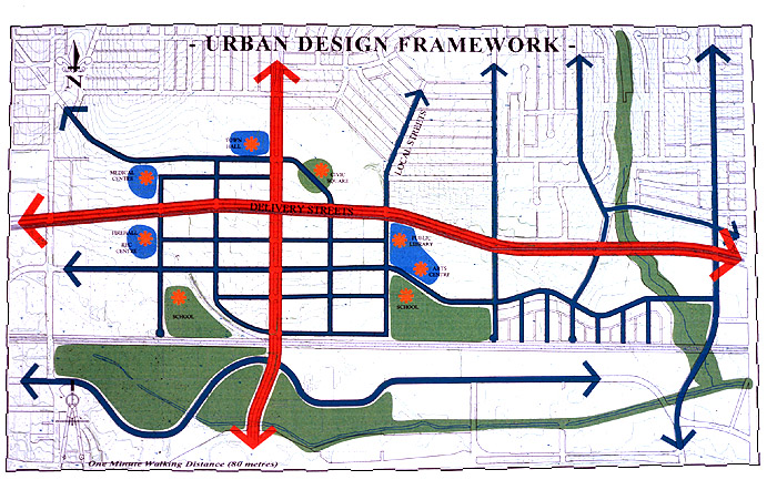
The
pedestrian-scaled circulation system becomes the means for
establishing a landscape and community structure. This structure
moves people and water efficiently while reducing regional
transportation requirements. Surrounding the community is
a civic square, a town hall, a public library, an arts centre,
schools, a firehall, a recreation centre, and a medical centre.