SUSTAINABLE URBAN LANDSCAPES
Alternative
Development Standards
for Sustainable Communities
for Sustainable Communities
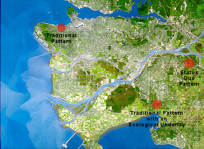
| The three study sites are indicated on this satellite photograph of the Greater Vancouver Metropolitan Region. Intensely urbanized areas appear grey, forest areas appear dark green, low density urban areas and agricultural areas appear light green. The Metropolitan region is bisected by the Fraser River - Vancouver and Burnaby occupy the north shore while Delta and Surrey are on the south shore. The City of Vancouver occupies the peninsula at the extreme left, bounded to the north by the Burrard Inlet. Surrey's most populated area appears as the grey region just south of where the Fraser River turns to the southwest. The study sites are indicated by red dots. |
 |